Wednesday, September 17, 2008

CT: Analyzing What Went Wrong

Thru-hiking a long trail such as the Colorado Trail is a different ball game from most of the outdoor pursuits I have experience with. And while I now consider myself knowledgeable and experienced at this, thru-hiking also proved one of the few pursuits that I wasn't successful with. Close friends and family have tried to convince me otherwise, but the stark undeniable fact remains: I did not thru-hike the Colorado Trail and was not successful at attaining that objective.

My Parents and friends have also tried to convince me of the fact that an ankle injury was beyond my control, and that nothing I could have done differently would have changed that fact. Perhaps they are right. The condition of Paul's knees were out of his control and I don't begrudge him that, so why should I consider this to be a personal failure on my part? On my last day before I left, David and I were engaged in many conversations about this, and he told me himself. "Tyler, you're harder on yourself than anyone I know." Perhaps this is another part of myself that I need to work on, but that will be the topic of another post.

I seriously hoped to succeed at this, and I still hope to return and thru-hike the whole Colorado Trail completely. So as I wait for my ankle to mend, I've been pondering and considering the successes and mistakes I made in this endeavor. I'll also be analyzing which of these factors contributed to my inability to complete the trail.

So in many ways, the following is simply a way for me to analyze what to do differently next time, and the things I have to accept as beyond my control.

SUCCESSES: I agree with David that I may be harder and more demanding on myself than I should be, so I'm going to start out with some things I thought I did well.

1. LOGISTICS: One thing I did do right, I believe, was in planning and logistics for the three of us. I did my homework, developed a resupply schedule, purchased meals that were MORE THAN ADEQUATE, and managed to get everything ready on time. I located places ready and willing to keep our supplies that would be more convenient than post offices, and generally predicted what to expect along the trail pretty well.

2. DETERMINATION: I wanted it badly enough and wasn't willing to give it up until it became absolutely essential for my health and well being. I never dropped out because I was sick of the rain (even when it was tempting to do so) nor did I ever call it quits for some other reason. I'm going to try to convince myself this speaks something about my character and will.

3. STOVE: The alcohol stove, I think, proved to be the best option for a trip of this sort. Alcohol was easy to locate when we needed it, and while we paid a bit of a weight penalty for our more extended excursions, I think it was generally a good, lightweight option. I think I'll stick with this for the next attempt.

4. CERTAIN FOOD CHOICES: Some food choices proved to work pretty well: Foods that were quick, nutritious, lightweight and provided good energy and/or protein worked well. These foods include: oatmeal breakfasts, grape nuts breakfasts (when not in overabundance), certain trail mixes, Nature Valley Granola Bars, couscous, backpacker's pantry meals, and Mountain House meals.
LITTLE MISTAKES: Some MINOR things I would do differently, but didn't necessarily affect the outcome.

1. FOOD OVERABUNDANCE: I purchased too much food. I had expected to be consuming many more calories than we actually did, and so consequently, we packed almost twice as much food as was necessary. While this proved a big mistake on the first section, by the time we reached our first and second resupplies, we knew what we could leave out. Simply an error of judgement, but not one that really hurt us in the long term (except the pocketbook). We often got our resupply boxes and sent 1/3 to 1/2 of the food right back home because we knew we wouldn't eat it all. To our credit though, we NEVER went hungry, so it was probably prudent that we erred on the side of caution as hunger could definitely have jeopardized the trip.

2. FOOD CHOICES: Certain foods were never consumed at all. This was PARTLY due to a misunderstanding of the nature of thru-hiking, bad calls on my part, and partly the result of untested gear. We brought along a lot of instant Jello pudding. Good for your weekend backpacking trips, when you spend more time sitting around the campfire eating, but not good on thru-hiking trips, when you're spending more time hiking and sleeping. It just didn't find a good place in our menu.

Pancakes turned out to be the same way. Fine for long weekends in the woods when you get a late start one day for a day hike, but not so great for thru-hiking, when you need to wake up super early every day and get some miles in before rain or other events might put you behind schedule. Simple foods that were quick and easy to prepare or required no preparation turned out to be the best options. Gear also proved a factor in this. Pancakes and eggs simply don't cook well on my new lightweight titanium cookware, which is essential for a trip of this nature (more on that later).

Other foods simply weren't being consumed, but this goes back to number 1. We'd often have leftover granola bars we didn't eat either because they didn't taste as good, or some other reason. Numerous foods weren't getting eaten throughout the trip and we'd typically arrive in towns ready for our next resupply and still be carrying a surplus of food.
Foods to leave out or cut down on next time include: Jello deserts, pancakes, freeze dried eggs, fish fry, fruits (for multiple reasons), certain bars, certain trail mixes, fruit roll ups (just corn syrup really), olive oil, hot chocolate, hot cider.

PREVENTABLE FACTORS CONTRIBUTING TO NEGATIVE OUTCOME

1. WEIGHT. PERIOD: The fact was, we were just too heavy. This slowed our progress, especially in the beginning and was probably a contributing factor to my ankle problem. Despite lightening our loads quite a bit prior to the trip (new gear, etc.) we just weren't the fanatics about grams and ounces that we should have been. We took a filter when we could have taken tablets. We took a GPS, etc.

While I'm not qualified to quantify the effect of weight on my ankle, I generally believe, and think that I could make a convincing argument that more weight= more stress on joints. Fair or not, I conclude that every choice I made with regard to heavier gear ultimately contributed to my negative outcome.

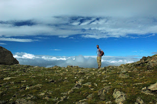
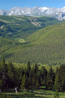
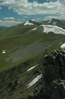
Seriously, though, I don't need a study to prove this assertion, just look at the pictures above! Which hikers are going to have more stress on their joints? Us or Steve? Who's going to have more fun? Us or Steve? Look at the pictures again and realize that Steve not only isn't sharing gear with friends, but he's also going 12 more days without supplies. Our gang's only prepared for 6 days. I'm now a believer that ultralight is the ONLY way to go.

2. FOOD WEIGHT: The biggest reason we were too heavy (see #1 above) was due to the weight of our food. I GROSSLY UNDERESTIMATED the importance of the weight of the foods I was carrying. I recall my dad watching as I bought 100 dollar titanium cookware and an aluminum stove and said, "you're stressing about the little stuff instead of worrying about the big stuff! And with respect to our food, he was right! During our second day, we met Steve, who carried enough supplies and gear for 12-14 days and weighed half as much as any of us. He said food weight to energy ratio of 130 calories per ounce. This proved to be a lot more restrictive than I originally thought. Even our Clif bars don't meet this requirement!

With the exception of our dinners, most of our foods proved to be in the 80-100 calories per ounce. During the trail, we consumed around 3500 calories per day. So for Steve, this comes out to 27 ounces per day, or 1.68 lbs. For us, at a value of say, 80 calories per ounce, 3500 calories weighs 43.75 ounces, or 2.73 lbs. That means that Dave, Paul, and myself were carrying a little over 1 pound of food per day. For the first 6 days, this means we're carrying 6 pounds in food that Steve doesn't have to carry. So for every stride, (6 extra pounds per stride) I end up putting 6 pounds more on my ankle. This could easily accumulate into thousands of more pounds on my joints than on Steve's after only 1 mile. Considering the trial is 480 miles, this could easily contribute to my ankle problems. Steve's ankles don't need to worry about this, so he's more likely to finish without injury.

3. GEAR CHOICES: Numerous choices of gear proved to be inadequate in that they were far too heavy. My pack weighed in at 3 1/2 pounds. Had I followed the principles above on FOOD WEIGHT, I could have carried an "ultralight backpack" that weighed in at roughly 1.5 pounds. 2 pounds less by choice of pack alone, and it would have decreased more had I followed the mistake above. I had examined and even tried on a couple packs like this, but elected not to buy them because I COULDN'T FIT ALL MY FOOD in them!

And while my choice of tent worked well for three people, the concept and thought processes that went into the purchase proved faulty for a thru-hiking setting. To reduce weight I should have gone with a combination shelter/raingear/rainfly product such as Six Moon Design's Gatewood Cape. I'm already carrying raingear and a rainfly. Why should I go to the trouble of carrying extra fabric (and weight) for a shelter? Why indeed. There are several products on the market similar to this one, and we should have elected to go with these instead. Might have shaved a few more valuable ounces and given us a little more volume (to cut down further on the size and weight of our backpacks).

Going ultralight has to be a completely holistic choice. If you bring pancakes and eggs, you have to bring a spatula, etc. Bring hot chocolate and you have to bring a cup. One too many extra things and you have to buy a bigger, heavier pack (which you fill with more stuff).


4. NOT ADDRESSING MY ANKLE PROBLEM SOON ENOUGH: I really should have changed things up sooner after I found my ankle problem wasn't going away. Perhaps then, I might not be analyzing what went wrong on my trip. When Paul started having knee problems, he quickly began wrapping them and got a knee brace as soon as possible. Ultimately he faced the same outcome I did, but at least Paul can live with the knowledge he did everything he could to remedy the situation. Would things have gone differently if I'd done the same? Things certainly couldn't have gone much worse had I began wrapping my ankle the moment it gave me problems, instead of 80 miles later when it was already too late. I should have gotten an ankle brace in Buena Vista when I had the chance. Ankle injuries beyond my control or not, taking preventative action early was the correct choice, and I didn't make that choice. So I list this as a contributing factor in the outcome.

5. POOR FOOTWEAR CHOICE: My boots proved to be a poor choice of footwear. My Vasque Switchbacks felt comfortable, which was good, but for an all leather boot they certainly didn't provide the ankle support I evidently needed. This was partly due to an inadequate understanding on my part about what I needed, which may or may not have been preventable. The front wore out a lot faster than I expected as well, and as the miles accumulated, I liked them less and less. My dad expressed later that he didn't think they were great boots. If I'd invested in something with better ankle support, would my weak ankles have held out longer? Possibly. So this goes in with contributing factors.


6. LACK OF DETERMINATION: While this appears completely contrary to the text above, I realize now I could have waited a week in Poncha Springs, and tried to finish the trail after my ankle was feeling somewhat better. While it would have been ideal, it was not necessary for me to finish with Dave. Ultimately, I gave up in Poncha Springs, instead of trying something different. Thinking back, I should have stayed in Poncha Springs or camped out at Marshall Pass alone while my ankle healed instead of retreating all the way back to Denver.

This is a tough call for a number of reasons and I hesitate to write it down. I'd be pushed to a later point in the season. I would have risked further permanent injury as staying in Poncha Springs would force me to be more active than staying in Denver. Still, I made the choice to quit the trail at Marshall Pass, and sane or not, logic dictates that this must be counted as a contributing factor (although one with many caveats). I guess Dave was right when he said I was hard on myself.

MODIFICATIONS: So, I hereby resolve to make the following changes/adjustments when I attempt to thru-hike the Colorado Trail again (and THERE WILL BE a second attempt).

1. ANKLE TREATMENT/TRAINING: I'm going to get my ankle looked at soon to check for stress fractures/other problems. I need a professional opinion and advice before proceeding.

2. TRAINING: After getting that advice, I'd like to begin some sort of program to treat and/or train my weak ankles either under professional guidance or self developed. This could include weight training for the ankles and surrounding muscles, prescribed physical therapy, or another training regimen deemed likely to contribute to a positive thru-hiking outcome.

3. TRAINING: I'm also going to make sure I'm in generally better physical condition when I attempt to hike it again. More long hikes and walking leading up to the hike.

3. ULTRALIGHT: Strictest adherence to the philosophies and doctrines of the most insanely fanatical ultralight purists. Ultralight pack; foods with 130 calories an ounce or better; no extraneous luxuries such as camera, headlamp, cups, etc.; 25 degree ultralight down bag; tablets instead of filters; Gatewood Cape Shelter or similar product, I'm going to seriously shoot for an under 8 lb. base weight (weight without food)

4. GAME PLAN TINKERING: I'm going to seriously consider a more frequent resupply schedule (to cut down further on weight) that adds Buffalo Creek, Copper Mountain, and Twin Lakes in addition to the 7 points I already have. I'm not sure yet how practical this would be and this will require some homework and study, but I'd be willing to make a couple extra trips into towns if I thought it might help matters.

5. GO NORTHBOUND: In case I can't thru-hike the trail on my second attempt, starting in Durango the second time around would ensure that I get to see the parts of the CT I missed the first time around. If anything, my experience on the trail disproves the axiom that if you put your mind to anything you can achieve it. I cannot guarantee success in Round 2 by having a better plan and making wiser choices. And as little as I want to face it right now, the fact may be that my body is simply not physically capable of completing this task. Going Northbound the second time will let me see the beautiful areas I miss, and help hedge against another negative outcome.

6. TOP NOTCH FOOTWEAR: My Dad told me about a guy in Estes Park who makes custom mountaineering boots. While expensive, such an option might give me the edge I need for a successful outcome. Regardless, the best high quality footwear available should be a top priority for any second attempt, complete with any prescribed orthotics, insoles, or other accessories. Cost and money will no longer be a consideration when it comes to footwear on my next attempt. My weak ankle will obviously tolerate nothing less.

7. HEALTHIER FOOD CHOICES: You are what you eat. I think if I generally stick to the 130 calories per ounce rule it should help matters. That means either making dehydrated meals myself, or buying freeze dried meals from Backpackers Pantry and Mountain House. Those meals generally meet the 130 Rule. Oatmeal is also generally lightweight and high in calories (although I have no ratio figures) I've also given serious thought to either doing without a stove, or refraining from cooking breakfast meals. If I did without a stove, I could likely also do away with carrying not only the stove, but fuel and possibly cookware also. I think a happy medium would be refraining from cooking breakfast though, cutting down on fuel, and saving time in the morning, which is much more critical than at night.

I may add to this as time goes on, and will probably be revisiting this list prior to my second attempt to thru-hike the Colorado Trail.

CT: Hanging With Dave in Silverton

CT Hiking Photos From Andy's Fragments

The Colorado Trail Story

CT Day 28: Hitching Back to Denver

I'd never really hitchhiked before the Colorado Trail, and consequently, I wasn't very good at it. I'd finally arrived in Poncha Springs in the early afternoon and was eager to get back to Denver for what I assumed would be a bit of a recovery process. It was easier said than done though.

Several people in the Poncha Springs Shell Station told me to try a truckstop in Salida, so I quickly found a ride there. Those people then told me that if I wanted a ride to Denver, I'd need to stay on US Highway 285, as most people in Salida were bound for Colorado Springs or Pueblo. So I quickly found another ride over in that direction. I'd gotten three rides to as many locations in Chaffee County within 10 minutes. Finally, to get a ride to Denver, I left another Shell station (I'd been soliciting rides there for 30 minutes) and started hiking up US-285 after losing my patience.

I hiked for 40 minutes up the highway before someone finally pulled over to pick me up. The two Western State College students from Gunnison, CO were headed to Colorado Springs to visit friends for a week and join a protest at the upcoming Democratic National Convention. They said they could drive me as far as Colorado Springs or Jefferson, (where they were turning off). I figured I'd have more luck in Colorado Springs than I was there, so I agreed to join them till they got to Colorado Springs.

I was immediately greeted (attacked?) by the friendliest golden retriever I'd ever met. Not 0.3 seconds after sitting down the older puppy jumped up on my face and started licking me. He wouldn't stop either! So I spent most of the ride to Colorado Springs fighting off animal dander and doggy slobber to the tune of endless Phish tapes.

My dread-locked hosts were nice for the most part, and we eventually reached Colorado Springs, where they dropped me off at the Interstate-25 junction. I figured from here I could easily get a ride into the Denver area or if worse came to worse, I could call my parents or get a bus.

Well the worse did indeed come to worse. I had ABSOLUTELY NO LUCK getting a ride out of Colorado Springs. I stood on two intersections for 40 minutes each without so much as a passing acknowledgement of my plight. I finally called my parents and they found me sometime about 8 PM for a drive back to their house in Denver.

CT: Analyzing What Went Wrong

Tyler Returns From Andy's Fragments

CT Hiking Photos From Andy's Fragments

The Colorado Trail Story

CT DAY 28: A Parting of Ways


Aptly marking the new low in our drama, the weather turned bad as well. Rain, wind, hail, and thunderstorms raged all night and pounded our tent. We woke to cloudy skies, a cold drizzle, and our first dusting of snow.

Getting up that morning and walking around, I knew that the miraculous ankle recovery I prayed for never came. The wisest course of action (indeed, the ONLY course of action) was making an exit at Marshall Pass. Even if I fought the pain and managed to limp along any further I would soon be forced off regardless and risked serious permanent damage to 1 or both of my feet. Had I gone further, I'd simply be in a much worse state, in far more remote and distant country where necessary help was likely to be much harder to find.

As we left the campground, a light snow dusted us on our remaining three miles to Marshall Pass. This was the first snowfall I'd seen since leaving Japan. David offered to go with me, but I wouldn't let him. He had to finish the trail for Paul and I.

At the Pass we had hoped to find more traffic and people around, so that I might find an easy ride into Poncha Springs. That didn't turn out to be the case though, so I walked along FS-200 hoping to find a ride soon. Several mountain bikers were in the area, but none had vehicles conveniently located. I turned down their offers to call Forest Rangers for a pickup, but I turned them down and took my chances hiking down the trail.

The small, muddy Forest Service road proved quite pretty, but hobbling 15 miles to Poncha Springs in my current state didn't make any sense. I wished I'd taken the bikers up on their offer. Now it was raining again, and I wasn't making very good progress, despite the easy grade. Fortunately, a couple in the area for day hiking passed by after an hour or so. I flagged them down and they gave me a ride to the campground at O'Haver Lake. I soon got another ride into the Shell Station at Poncha Springs along Highway 285.

CT Day 28: Hitching Back to Denver

The Colorado Trail Story

CT Day 27: Approaching Marshall Pass

We started again in the early afternoon from the Monarch Mountain Lodge. 10 miles into the hike though, I was hurting.... bad. While my one ankle had been bothering me for quite some time, it wasn't getting worse. So I figured I'd keep an eye on it and hope it either got better or somehow let me finish the trail. But somewhere during Segment 15 of the CT, I wrenched my OTHER ankle. Now I was leaning far more heavily on my (supposedly) weaker ankle!

Suffice it to say, I was a hurting unit, and my temperament probably reflected the pain my feet had me in. That most terrible of scenarios I dreaded since before passing through Twin Lakes almost 80 miles prior had now finally presented itself. Malfunctioning ankles were now forcing me off the trail. Almost as bad, the pain was preventing me from enjoying one of the better segments of the trail. We spent over half a mile wading through a field of wildflowers and I struggled to enjoy any of it.

I was noticeably slowing down as we crossed the Continental Divide and again reached the CT/CDT junction. It proved to be an eerie moonscape covered in fog. But despite our fantastic surroundings, both Dave and myself were growing more concerned about my injuries. Nearly every step I took proved painful and my hobbling and limping down the trail, as I leaned on my trekking poles certainly couldn't have been healthy for my stride. Like a snowball rolling downhill, things were quickly deteriorating for my feet.
So we camped a little early that day, in a lean-to shelter near the Green's Creek Trail about 10 miles in. It lies about three miles after gaining the Divide. Dave and I spent most of the night discussing the situation (mostly me yelling and complaining about all the work I'd put into this Trail and my frustration at my impending failure). I tried to rationalize continuing, but even I knew my case was pretty weak.

Dave and I agreed on loose plans then: for me to exit at Marshall Pass, where we would see the next dirt road (FS-200) and I could likely hitch a ride to Poncha Springs. I'd give Dave the stove and we could divide up the food in the morning. If I had a miraculous recovery the next day, I could try and move 1 trail segment further to the Sargent's Mesa Trailhead at FS-855. But I think both Dave and myself knew that wasn't going to happen.
CT Day 28: A Parting of Ways

The Colorado Trail Story

Friday, September 05, 2008

CT Day 26: Reaching Monarch Pass

After a long march during a rather dreary morning and early afternoon, we finally reached the US-50 highway. From here we would hitch a ride West to the Monarch Mountain Lodge along the highway, stay the night, and pick up our resupply box(es). We had reached Monarch Pass a day earlier than planned, which made a possible rendezvous with Paul kind of difficult, but we knew we needed to make mileage.

Unfortunately, NOBODY offered us a ride from the Colorado Trail/US-50 junction the four miles up to the lodge, turning an easy 12 mile half day into a full day of hiking. We were shocked, scandalized and outraged that not one of the hundreds of cars passing us bothered to give us a ride. It probably didn't help that the rainy weather made us look wet, turning otherwise good Samaritans into anal-retentive yuppies worried about the upholstery in their cars. I'm also willing to bet most of these people had probably spent the last 40 minutes trying to pass up big trucks and RVs, and were therefore unwilling to fall back behind them.

Either way, we finally reached the Monarch Mountain Lodge, picked up our boxes, and got a room. We had a steak dinner and soaked in their hot tub. And we found the lodge to be quite reasonably priced considering its spectacular location.

We managed to finish the daunting task of sorting through our ENORMOUS 3 boxes of food. We had packed food for 3 people and still had almost TWICE what we needed. Now with only two people, much of it was going to get thrown away. We gave some of it away to some friends we made at the resort, and still shipped a lot of the food back.

After that I went outside for one last soak in the hot tub.

SHAMELESS PLUG!: The owner of the Monarch Mountain Lodge was also kind enough to let us stash three big boxes at his business free of charge and without any expectation of reciprocity. Pretty cool I thought! So if you ever find yourself around Salida, Poncha Springs, or Monarch Pass and you are in need of a place to stay, consider heading up Highway 50 just east of Monarch Pass. The accomodations are simple, but well maintained and reasonably priced. It would be an IDEAL location to stay in the winter if you were to spend a long weekend skiing on the slopes at Monarch.

CT Day 27: Approaching Marshall Pass

Report On CT Hikers from Andy's Fragments

The Colorado Trail Story

CT Day 25: Princeton Hot Springs

Trudging along. First beautiful, sunny day we've had in quite awhile. Almost too hot and sunny. We stopped at Princeton Hot Springs after 7 or 8 miles in the morning. My ankle had been bothering me some, and I was hoping the hot waters would help things somewhat. Dave was also eager for the chance to try out the waters.

Princeton Hot Springs lies near Buena Vista, and is the center of a small, overpriced resort facility at the foot of the enormous Mt. Princeton. The naturally heated waters reminded me of all the onsen hot springs I used to frequent in the Japanese countryside, although this one was decidedly American in style. なつかしいい!

After finishing about noon, we had one more small hill to climb (about 1500 feet) and then we made a long trek South in the direction of Monarch Pass. During the afternoon we managed to make tons of progress, 10 miles or so almost directly South West, making for a 16-17 mile day.
We camped early that evening, and while building a fire, Thatch showed up. This time though, April was nowhere to be seen. He was much more cognizant today, although he reported feeling only slightly better. He told us how April had left him in the dust that morning, and was probably already hitching a ride into Salida to pick up supplies. This surprised me a bit. Despite Thatch's recent lethargy, he had the more impressive thru-hiker's resume, so I figured April would struggle to keep up with him. According to Thatch though, April was just bounding with energy, and he was constantly struggling to stay with his blond counterpart.

Thatch left and came back to our camp only 3 minutes later to report sighting a "huge" black bear on the trail just up ahead. He reported that the bear probably weight 300-400 lbs and wasn't more than 150 yards away. Needless to say, we thought it prudent to cook at least that far AWAY from our tents and make sure we thoroughly cleaned our cookware.

CT Day 26: Reaching Monarch Pass

The Colorado Trail Story

CT Day 24: Leaving Buena Vista

We left Buena Vista today. We had another big climb up a hill that afternoon. Jenny Pyle was kind enough to give us a ride back to the trailhead. And after saying our thank you's and goodbyes, we proceeded on at a leisurely pace, and covering only 6 or 7 miles that afternoon.

So you could imagine our surprise when April came up on us! We thought she and Thatch had passed us 3 days ago! Apparently they went into town as well, although we missed them. Nevertheless, April was there and as chipper as ever, telling us about how Thatch had taken some medication and wasn't feeling so well.

15-20 minutes later Thatch showed up himself, and indeed, was looking much the worse for wear! To cure a headache or some other ailment, he had taken some 10 year old prescription medication his friend had given him long ago. The medication was evidently intended for severe seizures. Dazed, confused, and lethargic in every sense, Thatch wasn't doing so well!

Despite Thatch's medical disaster, they were both trying to reach the Princeton Hot Springs before dark, so they might soak their tired bones. April wasn't having much sympathy for Patch's lethargy and left him in the dust again after we finished talking. It finally registered with Thatch that April had again bounded off down the trail without him like a 9 year old on a sugar high. After that he slowly lurched forward and mumbled something about catching up with her. Hopefully he'll be OK!

CT Day 25: Princeton Hot Springs

The Colorado Trail Story

Wednesday, August 13, 2008

CT Day 23: Rolled into Buena Vista


Dave and I woke up early for the 3-4 mile hike out. After a long downhill stretch, sighting a black bear (I think), and crossing Middle Cottonwood Creek, we begin searching for a ride into the sleepy little mountain town of Buena Vista.

The scale of the Collegiate peaks is particularly huge, and these are no exception. A highway rolls out East of us and we began trudging down the highway trying to wave a ride. FINALLY an old man and his little dog pull over and take pity on the thru-hikers.

Now here I am in Buena Vista! Hiked 60 or so miles from Leadville and passed through the Mt. Massive and Collegiate Peaks Wilderness Areas. These are some BIG MOUNTAINS! Buena Vista lies to the East of the Collegiate Range in the Arkansas River Valley. Its known for spectacular sunshine, river rafting, and big sky. In many ways, Buena Vista reminds me of the Owen's Valley in California, a wide open valley hemmed in by massive mountains to either side. Even the rain shadow pattern of the Collegiate Peaks mirrors its Sierra Nevada counterpart.

We are also lucky here, as we're staying with longtime family friend, Jennifer Pyle. My parents knew the Pyle family in Denver long before I was ever born, and their daughter, Jennifer Pyle now runs the Bongo Billy's Coffee Shop in Buena Vista. She was kind enough to let us stay with her and her awesome dog, and even let us drive around her old 250 Ford. That's a ride for sure!
Shameless Plug: Check out Jenny's Bongo Billy's Coffee when you get to Buena Vista! You'll know that your great coffee (or sandwich) is produced using sustainable techniques and is just really good. You can find Bongo Billy's on the East side of the highway, when you drive North into town.
From here, Dave and I (and possibly Paul if we locate him) will head further South, leaving the Arkansas Valley. We'll be passing Mt. Princeton, Mt. Antero, and Mt. Shavano before crossing Monarch Pass. I do not expect to have internet access at our Monarch Lodge resupply point.

From Monarch, we enter an 8-9 day, 100 mile stretch to Creede, CO which will be our longest unsupported leg of the journey. Please keep us in your thoughts and prayers!
I have no idea who these people are, but this is likely to be your response after having Bongo Billy's coffee!

CT Day 24: Leaving Buena Vista

Update on CT Hikers from Andy's Fragments

The Colorado Trail Story

CT Day 22: Fishing at Harvard Lake

Another LONG day with another BIG CLIMB!

We spent most of the morning leapfrogging with April and Thatch, but they finally passed us up when we reached Harvard Lake and Dave wanted to give fishing 1 last shot before mailing his fishing gear home.
Harvard Lake actually consists of two lakes. Lower Harvard Lake is far more picturesque than the mud pit constituting the upper lake. Consequently that's where I spent most of my time. Dave divided his time between the two for a couple of hours, and managed to make his biggest number of catches for the trip. Unfortunately, they were all far too small to bother frying up.

So we kept going, descending 2000 feet into the valley of North Cottonwood Creek, and then ascending another 4000 feet up the slopes of Mt. Yale. By the time we re-entered the Collegiate Peaks Wilderness Area, we were exhausted. Climbing a 4500 feet after doing 12 miles that morning is NOT RECOMMENDED. We made a short descent along the Southern slopes of Mt. Yale before camping out with a view of Mt. Princeton.
Tomorrow we would roll into Buena Vista, our next resupply point. My ankle was continuing to bother me but it certainly wasn't slowing us down. Another 15 mile day, this one also with a big climb near the end. I hope it heals up a bit while we're in Buena Vista.

CT Day 23: Rolled into Buena Vista


The Colorado Trail Story

CT Day 21: Campfire with Thatch and April

We woke up to VERY LOUSY weather and knew that it might be a very difficult day. We eventually managed to get moving though. My ankle was bothering me again, and I was getting increasingly concerned about it. I could manage to hike on it without it slowing us down, but the pain concerned me.

Despite the great pace we were setting, I wasn't dealing well with the weather or my ankle, and I'm certain I wasn't the most pleasant company to be around either. We still managed to climb two really big hills (over 4000 ft) and make 15 or so miles that day. We also entered the Collegiate Peaks Wilderness area. The Trail passed through Clear Creek and its miserable RV campground in the morning, but reached Pine Creek and the Wilderness Area boundary that afternoon. The same uncanny phenomenon occurred: upon entering the Collegiate Peaks Wilderness, views improved considerably.

Unfortunately, the weather wasn't as cooperative. Our first glimpse of the sun didn't occur until we crested our second big climb of the day, along the ramparts of Mt. Harvard above treeline. Beautiful place though. We really didn't have reliable sunshine till we camped that evening at Morrison Creek. We did manage to dry off all our gear, and after Herculean effort, got a fire started with sopping wet wood.

Our mood improved considerably with the sunshine. The intense rain and drizzle of the day had cleaned the air throughout the whole valley, and the flawless cobalt sky improved my morale considerably. Just when things couldn't get much better, April and Thatch from the Leadville Hostel show up and we all laugh, joke, and chat well into the night. Thatch and April both gave us stories of trails from their homes back East. Thatch had done the John Muir Trail and the Appalachian Trail.

Dave and I had risked not pitching the tent, so that we might be able to sleep under the stars. By the time we went to sleep that night though, clouds had formed. When we heard thunder, Dave and I frantically raised the tent over our bags. Just in the nick of time, as a torrential downpour and thunderstorm started only minutes after we finished!

CT Day 22: Fishing At Harvard Lakes

The Colorado Trail Story

CT Day 20: Lance Armstrong at Twin Lakes

Dave and I left as early as we could so that we might be able to witness the Leadville 100 Bike Race. While we got a bit of a late start, we managed to make excellent time, averaging more than 3 miles per hour. We reached Twin Lakes reservoir sometime in the late morning, hoping to cheer on some of the racing folks we met in Leadville.

For the Leadville 100 Race this year, Twin Lakes was both the 40 mile race checkpoint and the 60 mile race checkpoint. Dozens of support crews stood out ready to assist their riders and hundreds of spectators watched and cheered for the riders coming in.

We ran into a group of women supporting one rider. After some small talk and hearing of our trail journey, they offered us fresh turkey sandwiches, gatorade, and snacks! Sometimes being a thru-hiker is pretty nice. They also told us that Lance Armstrong would be coming through in about half an hour. The world famous, seven time Tour de France winner was locked in a duel for first place with Gunnison, CO Native and six time Leadville 100 winner David Weins.

Lance Armstrong and David Weins eventually did roll through, to thunderous applause from all the bystanders. At this point David Weins was slightly ahead, with Lance Armstrong trailing just him. With only 40 miles to go, and with Lance's reputation, all the locals who favored Weins began fearing for the worst.
Dave and I left shortly after the big Armstrong commotion, walking the opposite direction of most of the cyclists, as this small portion of the CT near Twin Lakes Reservoir coincided with the race. All the fastest cyclists (all of whom were still far behind Weins and Armstrong). Dave and I started dancing as we walked through, and all the spectators started cheering for us as well! It was a great time.

Some guy asked where we were hiking from and we told him Denver. He immediately gave us both some brews. Turns out his Japanese wife was there with him to watch a friend race, so I had a few questions for her.

That afternoon we went for a swim on the OTHER side of Twin Lakes and later ran into Patch. Patch had gone into Twin Lakes for a resupply, and was passing us late that afternoon. Despite quitting early and watching the race, we managed to put away 14-15 miles.
As for the 2008 Leadville 100 MTB, turns out David Weins won! Weins came in a couple minutes ahead of Armstrong with a flat rear tire! Both riders however, beat the previous race record (held by Weins) by about 20 minutes. To add some perspective and context for our cycling readers, Weins appears to be a force to be reckoned with. He also beat Floyd Landis by 2 minutes in the 2007 Leadville 100 as well. Read the Yahoo Sports account here.

David Hanson's account of that Day:
"We hurried to Twin Lakes for the Leadville 100 bike race that was passing through. We made friends with a number of racers at the hostel in Leadville, so we thought it would be fun to cheer them on. It was quite the scene, tons of people line up along the route to cheer and catch a glimpse of Lance Armstrong! The big drama of the race was whether the Local guy, Dave Wiens could beat Lance. Dave had won the event the last 5 years. He even beat Floyd LAndis last year. When they passed through Lance was slightly ahead. The crowd roared as they jetted by. These guys were beasts. A day or two later we heard from Patch that Dave had beat Lance by a minute or two, and that Dave crossed the finish with a flat tire. Legendary!
The best part of the race was making friends with people and eating their food. Laurel made us turkey sandwiches and gave us gatorade and an apple. We were hiking out along the same route as the race and people started cheering for Tyler and I. Then these guys asked us where we were coming from... When we answered, "we just walked from Denver." They replied, "Holy S#%*, you guys need a beer!" That was a nice way to cap off the event and continue."

CT Day 21: Campfire With Thatch & April

The Colorado Trail Story

CT Day 19: Mending My Ankle

After yesterday's ascent of Mt. Massive, we had, against my better judgment, hiked four more miles South along the trail so that we might be positioned to climb Mt. Elbert today.

That is precisely what David did. I however, had done something to my left ankle and thought it prudent to stay off it for the morning. So I watched from the tent while David left to go do Mt. Elbert, the highest peak in Colorado. While I was annoyed with my ankle, I wasn't too disappointed about missing the climb, as I'd done Mt. Elbert years ago before leaving to Japan.

So I futzed around in the tent, reading a book David brought along: Thomas Merton's Thoughts in Solitude. I didn't finish it, nor did I think particularly much of it. Some of his essays were convicting, but others just didn't impress me all that much. So between that, cleaning dishes, napping, and answering nature's call, I managed to stave off boredom until David returned from Mt. Elbert.

David finally returns sometime afternoon and reports success! Despite his fatigue, I convince him to move our down the trail with me a little bit further, so that I could have a chance to do a little something that day. So we find a better spot near a brook a couple of miles further South. Who should come along? But April and Thatch, who report that the Leadville 100 Mountain Bike Race would be happening tomorrow near Twin Lakes! They were going on further to catch the race earlier the next morning and reported some more gossip on people we knew from the trail.

Shortly thereafter, a tall, skinny,old bean-pole of a man showed up wearing the titanic, conspicuously red, Gregory Denali Pro Backpack. He asked if he could join us, as there were no other decent campsites around and we didn't mind the company. It turns out his name was Dave, he was 72 years old, and he was hiking the Continental Divide Trail for the second time. This guy was now the biggest stud we'd met so far. This particular section of the Colorado Trail coincided with the CDT, so we'd been meeting CDT hikers from time to time, but none so old, and none with such massive expedition size packs on them! His pack probably had the volume to carry our combined gear. He also carried a 35 year old Svee stove that ran on gasoline. The Scandinavian design worked and sounded like a jet engine.


Anyways, he proved to be very pleasant company, showing off his old school gear and describing the CDT in wonderful detail. He had reportedly done the CDT the previous year and found it too stressful and difficult to really enjoy. So he wanted to return and do it again, this time more relaxed and experienced so that he could enjoy it more and focus less on route finding and other obstacles.
Later that evening, a third thru-hiker joined us: Patch. He showed up at 8 PM as the light began to disappear. The hyperactive Patch is evidently a triple-crowner, who decided to do the CT to get away from his divorce and to lose a significant amount of weight. This guy was certainly wired! He'd done over 20 miles that day and was still talking and yammering with Dave well into the evening. Well, Patch was talking mostly, Dave mostly politely listened. He gave some good advice for my ankle though: ibuprofen every day. "Vitamin I," he called it. It would keep down the swelling, he said, while allowing the body to heal itself. Not one to lightly dismiss advice from the experts, I started taking it that evening.

Later on the trail, we would see Patch's name at the trail head registers along the way. He was making fabulous time, frequently 25 or more miles a day.

CT DAY 20: Lance Armstrong At Twin Lakes

The Colorado Trail Story

CT Day 18: Mount Massive

We woke up as early as possible, leaving our gear about 1/2 mile from the Mt. Massive trailhead. We were moving by 7 or 7:30 that morning. A little later than we'd hoped, but early enough for safety. But the weather had us very concerned about our climb and our ascent. Fog and clouds surrounded us on all sides. We spent most of the morning wondering when, not if, it would rain on our parade.

Still, we continued on undaunted, determined to tick another mountain off of our list. For David, this would be his third or fourth "14er" if I'm not mistaken. For myself, it would count as the tenth Colorado "14er" I had climbed. I've also been up Mt. Whitney and White Mountain Peak in California.

To date I have climbed:

1. Pikes Peak
2. Windom Peak
3. Sunlight Peak
4. Mt. Evans
5. Grey's Peak
6. Mt. Princeton
7. Mt. Elbert
8. Mt. Beirdstadt
9. Torrey's Peak
10. Mt. Massive

Mt. Massive was, on the whole, much as I expected it to be. It definitely ranks among the easier Colorado Mountain's I've climbed. It still turned out to be a magnificent summit. While we were disappointed and concerned about the weather early on, things cleared up later in the morning. On the main trail, there is one final saddle to gain before ascending along a ridge to the North. The weather cleared just moments before we arrived at the saddle, giving us unobstructed views above the clouds. I hadn't such views since climbing Mt. Fuji in Japan.
While the clouds came and went for most of the afternoon, they parted at various times to give us views of everything around, both East and West. Most of the time though, we felt we were in an ocean of clouds.
We didn't start descending until 10:30 or so, after spending some time on the top. After descending, we had hoped to position ourselves better for Mt. Elbert tomorrow, but my ankle started bothering me significantly, so we only hiked 4 miles further South along the Colorado Trail.
CT Day 19: Mending My Ankle

The Colorado Trail Story

CT Day 17: Positioning ourselves for Mt. Massive.


Wild Bill himself drove us up to the CT Trailhead where we left off so that we might continue our journey South towards our ultimate destination, Durango. We only hiked 9 or so miles in and camped in the Mt. Massive Wilderness Area as we wanted to be perfectly positioned for tomorrow's ascent of Mt. Massive.

When I first thought about doing the trail, I knew it would be a great way to achieve my lifetime goal of climbing every 14,000 foot peak in Colorado. Many native Coloradoans share the dream of standing atop all the "14er's in the state, but far less actually get around to doing them all. I believe there are 52 "14er's" in the state of Colorado, and I've only climbed about 10 of them. I originally planned to climb about 5-10 of the 14ers in the Collegiate Peaks.

When the Colorado Trail passes through the Western side of the Arkansas Valley, several "14ers" become accessible to thru-hikers in this valley alone; some more accessible than others. They include:

1. Mt. Massive
2. Mt. Elbert
3. Mt. Harvard
4. Mt. Yale
5. Mt. Princeton
6. Mt. Shavano
7. Mt. Antero

While I thought I could get at least 5 of these, this was ultimately proving impractical, as the underestimated physical demands of carrying food and finishing the trail alone were already chipping away at our mountaineering ambitions. Timing the ascent of a 14er while simultaneously making significant progress on the trail also proved difficult. If we wanted to move 12 miles per day, we needed to either slowly kill ourselves by hiking significant distances AFTER an ascent, or severely limit trail progress and force ourselves to carry more food and take more time. Something had to give.

Either way, we are determined to get at least one big mountain in, and tomorrow its gonna be Mt. Massive. At 14,421 feet, Mt. Massive stands as the second highest in Colorado and the third highest in the lower 48 states (correct me if I'm wrong). The picture above shows Mt. Massive.

CT Day 18: Mount Massive

The Colorado Trail Story

Wednesday, August 06, 2008

CT Day 16: Chillin' in Leadville at 10,200 Feet

It is now Day 16 or 17 of our first Thru-Hike. Followers of our journey will wish to know that we have now hiked 156 miles on the Colorado Trail from Denver.

We've had some good times and seen some good things, but things are not all well. Our dear comrade and hiking partner Paul Brodar has suffered a knee injury of curious cause. He had to drop out after hiking 14 or so miles over the pass from Breckenridge to Copper Mountain. He's hoping it will heal and he'll be able to join us again in a week when we get our next resupply in Buena Vista. We're definitely missing Paul's company on the trail and by the fire. Here's to the Neutron Star!

Our next stop is in Buena Vista, 60 0r so miles to the South. Dave and I will hopefully be able to meet up with Paul there and continue on. However, Dave and I are very much looking forward to climbing Mt. Massive, Mt. Elbert, and possibly Columbia or Harvard. The Collegiate peaks are definitely going to rock (that's all they are anyway).

We've also met many new people, including this beautiful golden retriever. Enter Thatch and April, two new friends and the huge crazy crowd of Leadville 100 bikers and runners all staying at the Leadville Hostel. These people rock! Training for 100 mile mountain bike and running races respectively.

CT Day 17: Positioning Ourselves for Mount Massive

More On the Colorado Trail From Andy's Fragments

The Colorado Trail Story
CT Day 15: 3 miles to Leadville

Another easy day, this time we only hiked 3 miles to the trail head, where we would thumb a ride into Leadville. Dave and I sort of planned it this way so that we could maximize our rest day in Leadville. So on an unbelievably clear and beautiful morning, we descended from Bear Lake down to a valley system just North of the Twin Lakes reservoir.

Following a heated discussion about which highway to take, we determined that we were indeed on the correct road, it just wasn't the road with any traffic! Three cars passed us in two hours, and only 1 was traveling our direction. The fourth driver we saw finally took pity on us and drove us both into what remains of the once glorious mining town of Leadville, CO.

We stayed at the always hospitable Leadville Hostel, run by the famous "Wild Bill" who is quite legendary for his hospitality towards thru-hikers. And like Mountain Outfitters in Breckenridge, Wild Bill let us stash a resupply at his place free of charge!

At the time, the Leadville Hostel was hosting numerous athletes training for the Leadville 100 Running and Mountain Biking race. There were several other CT thru-hikers as well. We saw Paul's name on the guest register and wondered where he was. Later on at the local brewpub, we saw Paul walking back towards the hostel and shouted to him across the street.

CT Day 16: Chillin' in Leadville at 10,200 feet

The Colorado Trail Story

CT Day 14: Holy Cross Wilderness & Bear Lake

While we made great mileage yesterday, today turned out to be somewhat wasteful, finishing only 8 miles, as my knee was bothering me for most of the morning and Dave decided to go fishing. I doubt I was very pleasant to be around. Somehow, Dave managed to put up with me though, and we continued on at a slow pace.

In light of my knee, we figured it would be best to take it easy this day, and only hiked 8 miles. The highlight turned out to be entering the very Southern tip of the Holy Cross Wilderness Area. The unspoiled, old growth trees and rugged granite greeted us at every turn.

In the early afternoon we reached Bear Lake and set up a camp. And despite the ravenous mosquitoes, it turned out to be a fairly good location. After early afternoon rain clouds cleared, David tried his luck again with fishing at the lake, but it apparently wasn't meant to be. I layed low and tried to stay off my aching knee, hoping it would heal enough and not jeopardize my finishing the Colorado Trail.

CT Day 15: 3 Miles to Leadville


The Colorado Trail Story

CT Day 13: 17 Miles to Tennessee Pass

Our biggest mileage day so far, Dave and I cruised through to Leadville in an ambitious bid to simply get some mileage done. Besides crossing Kokomo Pass and treeline early in the morning, most of the rest of the scenery during this segment was somewhat, ho-hum. We got eaten alive by mosquitoes and flies along certain parts, passing mostly through endless "matchstick forests" along the CO-24 Highway to Tennessee Pass.

Both Dave and I were pleased with our early morning progress and the mileage we were making throughout the day, so we continued along, regrettably speeding past Camp Hale at 3+ miles an hour without so much as a photograph.

We did stop briefly at the 10th Mountain Division Memorial along the CO-24 Highway at Tennessee Pass, but stopped for very little other than that. I also got a shot of these huge charcoal ovens from the olden days.

CT Day 14: Holy Cross Wilderness & Bear Lake

The Colorado Trail Story

CT Day 12: Parting at Copper Mountain.


Paul, Dave and I left early that morning from the higher Western Flanks of Tenmile Range, hoping to Reach Copper Mountain with plenty of time for Dave and I to go further, divide up the food and supplies, and to give Paul a chance to find a ride to Leadville.

Paul's plan now consisted of heading to Leadville, hoping his knees would heal back up, and then jumping back in at some point further in the trail. At 11:00 or so when we finally reached Copper Mountain and the highway, Dave and I immediately started rummaging through our food, fuel and gear, giving Paul what we thought we wouldn't need. We dropped one of the stoves, much of the fuel, A LOT of food. The GPS Paul had been carrying also didn't make the cut, as we hadn't used it in days, and had never actually had a real need for the device.

Once finished, we said our goodbyes and Dave and I hurriedly rushed through the ultramodern Copper Mountain Ski Resort. It almost looked busier with mountain bikers, day hikers, and Midwesterners on vacation than it did with skiers in the winter. Fortunately, after numerous miles of dodging out of shape day hikers, mountain bikers, and an entire smelly cavalry of mounted tourists, we ascended into the pristine beautiful tundra near Janet's Cabin.
Janet's Cabin belongs to the 10 Mountain Division Hut System. During the Second World War, the US Army trained the 10th Mountain Division in this part of Colorado as a special unit for alpine and winter warfare. A system of huts, loosely modeled after those in Switzerland, were constructed to assist in training. After World War 2, Many of the 10th Mtn. veterans returned to Colorado and established the ski resorts that made the state famous. While I've never had more than a passing interest in the stories and lore surrounding the 10th Mountain Division, the Cabin and its wonderful setting definitely caught my attention. We should be passing by their former base, Camp Hale, sometime tomorrow afternoon! I'll definitely want to stop and stare.

Dave and I both took some great pictures.

CT DAY 13: 17 Miles To Tennessee Pass

The Colorado Trail Story

CT Day 11: Over the Divide to Copper Mountain


We finally departed Breckenridge, and now faced another climb over the Continental Divide. This would also be the first time the Colorado Trail coincided with the Continental Divide Trail. Despite this, the distance from Breckenridge to Copper Mountain was only 13 miles or so. We would be cresting Tenmile Range and would get some spectacular views.

On reaching the divide, we ran into and met a new friend, Justin Butts. Justin entertained us with hilarious stories about his travels to India.

Unfortunately, this also turned out to be the Day Paul's knees refused to let him go any further. He managed to make it over the divide, and claimed to be able to reach Copper Mountain, but David and I were very concerned about him. Luckily for him, we enjoyed the best sunset of the entire trip that evening.

CT Day 12: A Parting at Copper Mountain

The Colorado Trail Story